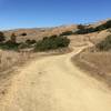
“Native American for "smooth, wide, fast." ”
2.0
Miles3.2
KMDoubletrack

Local Club: Marin County Bicycle Coalition
Land Manager: California State Parks - Tamalpais State Park
 Repack via Deer Park Fireroad
12.8 mi 20.6 km • 1,622' Up 494.47 m Up • 1,618' Down 493.26 m Down


 Fairfax, CA
 To Tamarancho and Beyond (auto free)
30.4 mi 48.9 km • 4,394' Up 1339.17 m Up • 4,364' Down 1330.16 m Down


 San Rafael, CA
 Tennessee Valley/Muir Beach Singletrack Highlights
20.7 mi 33.3 km • 3,233' Up 985.27 m Up • 3,235' Down 985.89 m Down


 Tamalpa…, CA
 Golden Gate to Tennessee Beach Loop
17.9 mi 28.9 km • 2,443' Up 744.76 m Up • 2,477' Down 755.02 m Down


 Sausalito, CA
 Marin Fire Road Loop
27.3 mi 44.0 km • 4,309' Up 1313.28 m Up • 4,307' Down 1312.85 m Down


 Lagunit…, CA
 Havey Trail Loop
5.2 mi 8.3 km • 1,044' Up 318.24 m Up • 1,050' Down 319.93 m Down


 East Ri…, CA


1 Comment