
 Continue with onX Maps
 Continue with Facebook


 Easy/Intermediate

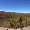
“This doubletrack provides access to a handful of trails in DuPont's southwestern most corner. ”


2.0
Miles3.2
KMDoubletrack
 Easy/Intermediate
Local Club: Pisgah Area SORBA
Land Manager: North Carolina Forest Service - Dupont State Forest
 Most Excellent - Dupont West Side
21.5 mi 34.7 km • 2,552' Up 777.88 m Up • 2,552' Down 777.95 m Down
 Brevard, NC
The Best of Dupont: Burnt Mtn. / Cedar Rock Big Rock Figure-Eight
Brevard, NC
The Best of Dupont: Burnt Mtn. / Cedar Rock Big Rock Figure-Eight
6.3 mi 10.1 km • 773' Up 235.55 m Up • 772' Down 235.17 m Down
 Brevard, NC
 DuPont - Micajah to Wilkie Loop
2.9 mi 4.7 km • 354' Up 107.96 m Up • 355' Down 108.15 m Down
Turkeypen Gap to Black Mountain Loop
23.3 mi 37.5 km • 3,568' Up 1087.56 m Up • 3,570' Down 1088.22 m Down
Avery Creek to Bennett Gap Loop
15.7 mi 25.2 km • 3,013' Up 918.33 m Up • 3,017' Down 919.45 m Down
Brevard, NC
Pisgah Long Tour
27.2 mi 43.7 km • 3,591' Up 1094.45 m Up • 4,637' Down 1413.3 m Down
Mills R…, NC


 All Clear


0 Comments