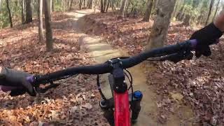
I created this featured ride to encompass most of the trails that were rebuilt in 2015 around Lake Imaging trail access area. Most of these trails are smooth and flowy at the moment, so get out and enjoy before the horses destroy it. Because it is "new," the area will be congested on the weekends with horses, bikers and hikers.
These trails are popular at the moment so keep your eyes pointing up the trail looking for folks descending the trails.
This ride starts off with a 1.5 mile of climb up
Jim Branch. Once at the top of
Jim Branch, take a right on
Isaac Heath which meanders along with a couple of nice flowy sections. This trail ends at
Locust trail so continue right onto
Locust.
Locust starts with a moderate climb and then descends about 100 feet where speeds can reach over 25mph.
Locust will end at
Lake Imaging Road. Continue to the right to prepare for
Hilltop trail.
Hilltop's excitement level depends on your fitness as it takes some power to maintain speed through the small ascents and descents.
After exiting
Hilltop loop, you'll intersect with
Lake Imaging Road where you'll take a right. Take the next left onto
Buck Forest Road where you can either relax or stretch your legs out on a bit of fire road up to
Hickory Mountain Road intersection. Take a left on
Hickory Mountain Road for a bit more of riding on a fire road, taking a left on White Pine Trail. White Pine Trail is a connector trail to your next descent:
Hooker Creek Trail. This is a really fast section of trail that keeps you on your toes as you descend down to
Hooker Creek.
After this descent there's a bit of climbing to get back up where you'll take a right on
Ridgeline trail. Climb
Ridgeline a bit watching for
Hickory Mountain Loop on your left. My Featured Ride has you going clockwise with a stiff climb in the beginning. I've heard people say CW is more fun and some say CCW is more fun. If you have the time, try it both ways and judge for yourself. Either way, this trail is the most technical with mostly rock features, that IMO, destroys a lot of the flow to this trail. While this trail isn't part of the 2015 rebuild, it's only about a year old, and worth doing.
After
Hickory Mountain Loop, you start a bit of backtracking back to
Hooker Creek. From
Hickory Mountain Loop , take a left onto
Hooker Creek Trail where you descend immediately. Unfortunately, you get to ascend all the flowy goodness you experienced moments ago. After you reach the top of
Hooker Creek at the intersection of White Pine Trail, take a right that will connect you back onto
Buck Forest Road.
Continue to backtrack by taking a right onto
Buck Forest Road where you'll make quick work of this road as it's all downhill back to
Lake Imaging Road. Take a right onto
Lake Imaging Road where you'll climb for a few minutes (passing the exit to
Hilltop loop) until you reach
Locust again. Take a right on
Locust being prepared for a quick climb with a short rewarding descent back to the intersection of
Isaac Heath. We're continuing to backtrack by keeping left onto Issac Heath back to the top of
Jim Branch. You end the ride with a fast descent down
Jim Branch back to Lake Imaging parking area. I intentionally excluded
Ridgeline on this ride, but if you're up for it, climb and descend
Ridgeline to finish the ride.
At various points during this ride, there are bailouts with short distances back to the car. Your first and last bailout point is on
Buck Forest Road where you can opt to take
Jim Branch back to the car. Your next good bailout is taking
Hickory Mountain Road all the way to
Ridgeline and take
Ridgeline back to the car. The third bailout is at the end of
Hooker Creek where you can take a left onto
Ridgeline and take
Ridgeline back to the car. You also have the option of descending
Ridgeline after
Hickory Mountain Loop.

 Continue with onX Maps
 Sign in with Facebook


 Intermediate/Difficult

 4.2 (10)


1 Comment