
 Continue with onX Maps
 Continue with Facebook


 Easy/Intermediate

“This doubletrack provides access to a handful of trails in DuPont's southwestern most corner. ”


2.0
Miles3.2
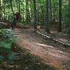
KMDoubletrack
 Easy/Intermediate
Local Club: Pisgah Area SORBA
Land Manager: North Carolina Forest Service - Dupont State Forest
 DuPont Ridgeline
6.3 mi 10.1 km • 697' Up 212.55 m Up • 694' Down 211.63 m Down

 Brevard, NC
 Pisgah Stage Race - Stage 5
28.5 mi 45.8 km • 2,863' Up 872.78 m Up • 2,780' Down 847.39 m Down
Brevard, NC
Pisgah 55.5K MTB Race
38.4 mi 61.8 km • 7,798' Up 2376.79 m Up • 7,800' Down 2377.3 m Down
Brevard, NC
Black Mountain Loop
13.7 mi 22.0 km • 2,147' Up 654.34 m Up • 2,106' Down 642.04 m Down
Brevard, NC
Turkeypen Gap to Black Mountain Loop
23.3 mi 37.5 km • 3,568' Up 1087.56 m Up • 3,570' Down 1088.22 m Down
Cove Creek Loop
10.0 mi 16.0 km • 985' Up 300.16 m Up • 986' Down 300.58 m Down
Brevard, NC


 All Clear


0 Comments