MTB Project Logo

No unavoidable obstacles. This is an all-access trail to other optional trails


Your Rating: Rating Rating Rating Rating Rating      Clear Rating
Your Difficulty:
Your Favorites: Add To-Do · Your List
Zoom in to see details
Map Key

2.8

Miles

4.6

KM

Singletrack

2,030' 619 m

High

1,935' 590 m

Low

182' 56 m

Up

180' 55 m

Down

2%

Avg Grade (1°)

10%

Max Grade (6°)

Dogs Off-leash

E-Bikes Unknown

Description

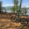
Central Loop, when ridden counter-clockwise, starts you out with some simple easy trails. There are no unavoidable obstacles, and this trail will provide you with access to the other trails within this looped system. It follows along the lake shore for the first 1.25 miles where you'll intersect with Burnt Tree Peninsula.

Continuing on, you'll come to Yotees Run intersection. In order to reach Burrell Cove Trail, you'll need to leave the Central Loop and travel about 100 yards to the next signed intersection. Otherwise, continue left to stay on Central Loop. The next signed intersection, which is in about a mile, is the end of Burrell Cove Loop. Shortly after this intersection is the steepest climb on Central Loop. I say steepest because it is the only one of any duration, but is very do-able by even a novice rider.

At the top of this climb is what I refer to as the Grand Intersection. Its a very wide spot in the trail where several lollipops branch off from it. To the right is Sneaking Creek and to the left is Upper Ridge Loop. Straight ahead, albeit somewhat right-ish is the final stretch of Central Loop. Its up and down with some slightly technical rooty areas but then finishes with a wonderful flowing downhill that has a few tight turns including a left-handed switchback near the end.

Obviously, if you ride Central Loop clockwise, it will start out with this uphill pull that will increase the difficulty factor considerably.

Another option is to ride it counterclockwise to the Grand Intersection and then ride it back out in the clockwise direction. The trail then will give you around a 5-mile ride that is enjoyable for beginner and novice riders.

Color on Map: White
Ability Level: Green

Contacts

Shared By:

Michelle Shuford

Trail Ratings

  4.1 from 10 votes

#8907

Overall
  4.1 from 10 votes
5 Star
40%
4 Star
30%
3 Star
30%
2 Star
0%
1 Star
0%
Trail Rankings

#274

in North Carolina

#8,907

Overall
3 Views Last Month
549 Since Jul 6, 2015
Easy/Intermediate Easy/Intermediate

56%
22%
11%
0%
11%
0%

Photos

Example of trail sign at trailhead.
May 8, 2015 near Hayesville, NC
Trailhead information kiosk.
May 8, 2015 near Hayesville, NC
Sign for the entrance to the "skills" area.  A little short pump/skills track to get you started out.
May 8, 2015 near Hayesville, NC

0 Comments

Weather


Current Trail Conditions

All Clear 24 days ago
Add Your Check-In

Check-Ins

Apr 16, 2020
Adam Kunce
Great ride 6mi — 1h 00m
Sep 1, 2019
Brian Lucy
3.8mi
Dec 24, 2018
Lost Justpastnowhere
Aug 6, 2017
Bryan B
Oct 23, 2016
Derek Rutkosky
Welcome

Join the Community

Create your FREE account today!
Already have an account? Login to close this notice.

Get Started