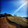
“A steady fire road descent from Curry Point into Curry Canyon. ”
2.6
Miles4.1
KMDoubletrack

Local Club: Bicycle Trails Council of the East Bay
Land Manager: California State Parks - Mount Diablo State Park
 Dan Cook, Wall Point Loop
11.3 mi 18.2 km • 1,558' Up 474.84 m Up • 1,557' Down 474.64 m Down


 Diablo, CA
 Old Borges Ranch Double Loop
6.5 mi 10.4 km • 756' Up 230.58 m Up • 752' Down 229.29 m Down


 Walnut…, CA
 Stewartville & Ridge Trail Loop
8.3 mi 13.3 km • 1,328' Up 404.88 m Up • 1,373' Down 418.36 m Down


 Clayton, CA
 Briones Loop-de-Loop (Auto Free)
20.3 mi 32.7 km • 2,592' Up 789.95 m Up • 2,857' Down 870.95 m Down


 Lafayette, CA
 MacDonald-Goldenrod Loop
7.8 mi 12.6 km • 1,339' Up 408.11 m Up • 1,346' Down 410.26 m Down


 Moraga, CA
 Joaquin Miller Park Standard XC Loop
6.0 mi 9.6 km • 694' Up 211.65 m Up • 756' Down 230.38 m Down


 Oakland, CA


0 Comments