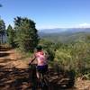
“A two mile trail along Lewis Creek through the trees. ”
2.1
Miles3.4
KMSingletrack

Land Manager: USFS - Sierra National Forest Office
 Big Trees
27.0 mi 43.5 km • 3,604' Up 1098.48 m Up • 3,602' Down 1098.01 m Down


 Oakhurst, CA
 Devils Peak Ride (Signal Peak Lookout Tower)
24.4 mi 39.2 km • 3,327' Up 1014.18 m Up • 3,329' Down 1014.57 m Down


 Oakhurst, CA
 Buckridge at Lake Hensley
5.7 mi 9.2 km • 660' Up 201.22 m Up • 660' Down 201.31 m Down


 Bonadel…, CA
 Perimeter, Nevin's, Musick Loop
5.4 mi 8.6 km • 410' Up 124.99 m Up • 410' Down 124.92 m Down


 Auberry, CA
 Pilots Peak Route
15.5 mi 24.9 km • 2,209' Up 673.31 m Up • 2,216' Down 675.49 m Down


 Midpines, CA
 Smith Peak
11.3 mi 18.2 km • 1,573' Up 479.43 m Up • 1,568' Down 478.05 m Down


 Tuolumn…, CA


1 Comment