MTB Project Logo

Ride to the top of one of the tallest mountains in the Sierras with amazing views of Yosemite National Park.


Your Rating: Rating Rating Rating Rating Rating      Clear Rating
Your Difficulty:
Your Favorites: Add To-Do · Your List
Zoom in to see details
Map Key

24.4

Miles

39.2

KM

15%

Singletrack

6,962' 2,122 m

High

5,104' 1,556 m

Low

3,327' 1,014 m

Up

3,329' 1,015 m

Down

5%

Avg Grade (3°)

28%

Max Grade (16°)

Dogs Unknown

E-Bikes Unknown

Closed in the winter due to snow. Be careful after a rain, very muddy conditions.

Overview

A steady forest road climb is rewarded by breathtaking view at the top of Yosemite and the Central Valley. Follow this up with a fast and fun descent for a perfect day-ride.

Need to Know

There's substantial deep dust in the beginning on County Road 16 (Cowchilla Mountain Road), hence taking Forest Road 5S09X. Take water with you and some snacks, you'll need it at the top. Getting to the top is very rocky, but the road is wide.

Description

There's a lot to explore in this area; dirt roads that connect Fish Camp to Mariposa and Yosemite National Park (Wawona). Overall, this out-and-back starts with a regular climb from Fish Camp, then the road goes two miles downhill and then continues a solid climb all the way to the top.

There are just a few turns that you have to do to get to the top along County Road 17 (Summit Road), Tenmile Grade (4S04), and Devil's Peak Summit Road #4S31. Follow the map or MTB Project mobile app and you are going to be fine.

This makes for a great workout with a rewarding view and cool downhill on the defunct moto trails Chowchilla Trail (21E340) and Mountain Trail (21E248). On the way back, reserve some energy for the two miles uphill to Fish Camp. Grab a hamburger and a beer at Tenaya Lodge that is just across the street.

History & Background

Part of the old road to Yosemite that President Roosevelt did by horse from Raymond train station.

Contacts

Shared By:

Coco Negrete

Trail Ratings

  4.0 from 2 votes

#2686

Overall
  4.0 from 2 votes
5 Star
50%
4 Star
0%
3 Star
50%
2 Star
0%
1 Star
0%
Recommended Route Rankings

#337

in California

#2,686

Overall
23 Views Last Month
4,932 Since May 8, 2017
Intermediate Intermediate

0%
0%
100%
0%
0%
0%

Photos

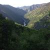
A great rewarding view once you get to the top!
Nov 10, 2019 near Midpines, CA
Looking east from the tower!
Jul 19, 2018 near Midpines, CA
Looking into Yosemite from the top of Devils Peak.
May 8, 2017 near Midpines, CA
The custodian of the lookout tower waves good bye on a sunny evening.
May 8, 2017 near Midpines, CA
Top of the mountain, Yosemite in the background.
May 8, 2017 near Midpines, CA

0 Comments

Weather


Current Trail Conditions

Unknown
Add Your Check-In

Check-Ins

none
Welcome

Join the Community

Create your FREE account today!
Already have an account? Login to close this notice.

Get Started