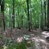
“Incredible descending singletrack that leads to fantastic flowing finish, switchback included. ”
1.2
Miles1.9
KMSingletrack

Land Manager: Tennessee Wildlife Resources Agency
 Black Oak Ridge
11.4 mi 18.4 km • 1,437' Up 437.86 m Up • 1,434' Down 437.19 m Down


 Kingston, TN
 Windrock XC
3.8 mi 6.2 km • 756' Up 230.46 m Up • 767' Down 233.8 m Down


 Oliver…, TN
 FreeRide to Talladega to Red Bull Drop and Step Up
1.4 mi 2.3 km • 19' Up 5.71 m Up • 1,002' Down 305.36 m Down


 Oliver…, TN
 Concord Park
8.2 mi 13.1 km • 1,016' Up 309.56 m Up • 1,016' Down 309.82 m Down


 Farragut, TN
 Norris Watershed
12.1 mi 19.5 km • 2,041' Up 622.11 m Up • 2,042' Down 622.46 m Down


 Norris, TN
 City Side Scenic Loop
5.9 mi 9.5 km • 805' Up 245.43 m Up • 811' Down 247.2 m Down


 Norris, TN


0 Comments