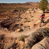
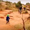
“An easy connection between many trails in the Sovereign area. ”
1.3
Miles2.1
KMDoubletrack

Local Club: Moab Trails Alliance
Land Manager: State of Utah School and Institutional Trust Lands Administration
 Beginner Klonzo Loop
5.8 mi 9.4 km • 677' Up 206.22 m Up • 681' Down 207.46 m Down


 Moab, UT
 Hey Joe Safari Bikepack
99.0 mi 159.3 km • 5,545' Up 1690.05 m Up • 5,550' Down 1691.55 m Down


 Moab, UT
 Intermediate Brands Loop
7.9 mi 12.7 km • 742' Up 226.25 m Up • 742' Down 226.09 m Down


 Moab, UT
 Bar M Loops
10.9 mi 17.6 km • 720' Up 219.4 m Up • 719' Down 219.28 m Down


 Moab, UT
 Intermediate Klondike Loop
6.1 mi 9.8 km • 744' Up 226.78 m Up • 744' Down 226.81 m Down


 Moab, UT
 Mag 7
Mag 7
21.2 mi 34.0 km • 1,294' Up 394.4 m Up • 3,331' Down 1015.44 m Down


 Moab, UT


0 Comments