Continue with onX Maps
 Sign in with Facebook


Dixie National Forest
 UT
UT- Southwestern Utah
- Dixie National Forest


Recommended Routes in Dixie National Forest - 6
MTB Project is built by riders like you. Add Your Recommended Routes


 Intermediate/Difficult
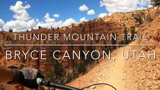
Thunder Mountain Trail
8.1 mi 13.1 km • 689' Up 210.11 m Up • 1,681' Down 512.29 m Down

 Panguitch, UT
Intermediate/Difficult
Panguitch, UT
Intermediate/Difficult
Thunder Mountain Loop
15.9 mi 25.7 km • 1,627' Up 495.91 m Up • 1,633' Down 497.66 m Down
Panguitch, UT

 Intermediate
Navajo Lake Loop
11.2 mi 18.0 km • 635' Up 193.65 m Up • 635' Down 193.57 m Down
Parowan, UT
 Intermediate
Navajo Lake and Virgin River Rim
13.8 mi 22.2 km • 1,132' Up 344.97 m Up • 1,128' Down 343.78 m Down


Dixie National Forest Biking
- 296 Miles 476 Kilometers of Trail
- 6 Recommended Routes
- 7
Easy Trails

- 14
Intermediate Trails

- 6
Difficult Trails

Areas Within Dixie National Forest
Weather Averages
|
High
|
Low
|
Precip
|
Days w/
|
| J | F | M | A | M | J | J | A | S | O | N | D |
Trails in Dixie National Forest - 21
MTB Project is built by riders like you. Add Your Trails
|
7.0
mi
11.3
km
#1Navajo Lake South
Intermediate
Parowan, UT
|
Intermediate
|
Parowan, UT |
1
|
|
8.9
mi
14.2
km
#2Red Canyon Bike Trail #33016
 Easy
Easy
Panguitch, UT
|
Easy
|
Panguitch, UT |
7
|
|
|
8.7
mi
14.0
km
#3Cassidy Trail #33093
Intermediate/Difficult
Panguitch, UT
|
Intermediate/Difficult
|
Panguitch, UT |
8
|
|
2.6
mi
4.1
km
#4Hollowpoint
 Difficult
Washington, UT
|
Difficult
|
Washington, UT |
4
|
|
|
5.7
mi
9.2
km
#5South Draw Road
Intermediate
Loa, UT
|
Intermediate
|
Loa, UT |
4
|
|
|
1.5
mi
2.4
km
#6Dike Trail
Intermediate/Difficult
Parowan, UT
|
Intermediate/Difficult
|
Parowan, UT |
4
|
|
|
3.1
mi
5.0
km
#7Losee Canyon Trail #33090
Intermediate
Panguitch, UT
|
Intermediate
|
Panguitch, UT |
2
|
|
|
2.2
mi
3.6
km
#8Rich Trail #33092
Intermediate
Panguitch, UT
|
Intermediate
|
Panguitch, UT |
2
|
|
|
2.0
mi
3.3
km
#9FS Road 30650A
Easy
Panguitch, UT
|
Easy
|
Panguitch, UT |
4
|
|
|
2.1
mi
3.5
km
#10Coyote Hollow Road (FSR #113)
Easy
Panguitch, UT
|
Easy
|
Panguitch, UT |
4
|
Photos of Dixie National Forest - 151
MTB Project is built by riders like you. Add Your Photos