Continue with onX Maps
 Sign in with Facebook


Sacramento, Folsom, and Roseville
 CA
CA- Sacramento Valley
- Sacramento, Folsom, and Roseville


Recommended Routes in Sacramento, Folsom, and Roseville - 6
MTB Project is built by riders like you. Add Your Recommended Routes


 Intermediate
Granite Bay Trail
7.3 mi 11.7 km • 519' Up 158.32 m Up • 520' Down 158.61 m Down

 Intermediate
Salmon Falls (Darrington Trail)
15.9 mi 25.6 km • 717' Up 218.52 m Up • 717' Down 218.57 m Down

 Easy/Intermediate
Lake Natoma Loop
12.0 mi 19.3 km • 294' Up 89.75 m Up • 294' Down 89.48 m Down


Sacramento, Folsom, and Roseville Biking
- 93 Miles 150 Kilometers of Trail
- 6 Recommended Routes
- 25
Easy Trails

- 19
Intermediate Trails

- 5
Difficult Trails

MTB Project is built by riders like you. Share
what you know about this area!
Areas Within Sacramento, Folsom, and Roseville
Weather Averages
|
High
|
Low
|
Precip
|
Days w/
|
| J | F | M | A | M | J | J | A | S | O | N | D |
Trails in Sacramento, Folsom, and Roseville - 43
MTB Project is built by riders like you. Add Your Trails
|
3.5
mi
5.6
km
#1Dike 8 - Browns Ravine
Intermediate
El Dorado Hills, CA
|
Intermediate
|
El Dorado Hills, CA |
25
|
|
2.6
mi
4.1
km
#2Johnny Cash Trail
 Easy
Easy
Folsom, CA
|
Easy
|
Folsom, CA |
1
|
|
|
0.6
mi
1.0
km
#3Ranch Trail
Intermediate
Pilot Hill, CA
|
Intermediate
|
Pilot Hill, CA |
1
|
|
|
4.9
mi
7.9
km
#4Folsom Bike to Granite Bay Connector
Easy/Intermediate
Folsom, CA
|
Easy/Intermediate
|
Folsom, CA |
14
|
|
|
11.1
mi
17.9
km
#5South Fork ART (American River Trail)
Intermediate
Granite Bay, CA
|
Intermediate
|
Granite Bay, CA |
17
|
|
|
3.0
mi
4.9
km
#6Chaparral Ridge
Intermediate
Pilot Hill, CA
|
Intermediate
|
Pilot Hill, CA |
3
|
|
|
1.0
mi
1.6
km
#7Acorn Creek Trail
Intermediate
Granite Bay, CA
|
Intermediate
|
Granite Bay, CA |
6
|
|
|
4.5
mi
7.3
km
#8Southeast Option
Easy/Intermediate
Rancho Murieta, CA
|
Easy/Intermediate
|
Rancho Murieta, CA |
5
|
|
|
5.1
mi
8.2
km
#9American River Bike Trail: South Side Lake Natoma
Easy/Intermediate
Gold River, CA
|
Easy/Intermediate
|
Gold River, CA |
8
|
|
|
2.6
mi
4.2
km
#10Sweetwater Trail
Intermediate
El Dorado Hills, CA
|
Intermediate
|
El Dorado Hills, CA |
15
|
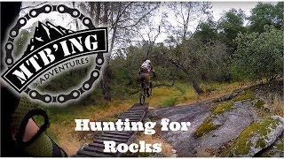
Photos of Sacramento, Folsom, and Roseville - 174
MTB Project is built by riders like you. Add Your Photos