
 Continue with onX Maps
 Continue with Facebook


 Intermediate/Difficult


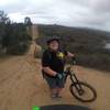
“Steep climb toward Sierra Peak from the Santa Ana River Trail. ”


3.9
Miles6.3
KMDoubletrack


0 Comments