
 Continue with onX Maps
 Continue with Facebook


 Intermediate/Difficult

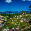
“The beginning section of the complete SART. ”


10.6
Miles17.1
KMSingletrack
 Intermediate/Difficult
Land Manager: USFS - San Bernardino National Forest Office
 Bear Mountain to Wildhorse Meadows
21.0 mi 33.8 km • 2,365' Up 720.91 m Up • 2,366' Down 721.12 m Down
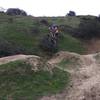
 Cactus Flats OHV
5.8 mi 9.3 km • 535' Up 162.94 m Up • 536' Down 163.46 m Down
 Bluff Lake Loop
21.6 mi 34.8 km • 2,259' Up 688.54 m Up • 2,249' Down 685.56 m Down
Big Bea…, CA
El Dorado Ranch
7.2 mi 11.6 km • 815' Up 248.46 m Up • 813' Down 247.88 m Down
 First Hump (Scott Ridge) Loop
2.7 mi 4.3 km • 374' Up 113.95 m Up • 382' Down 116.45 m Down
Jedi Tree and Back
4.2 mi 6.7 km • 484' Up 147.51 m Up • 497' Down 151.54 m Down
Loma Linda, CA


0 Comments