
 Continue with onX Maps
 Continue with Facebook


 Intermediate/Difficult


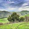
“A fairly easy downhill on big doubletrack. ”


0.6
Miles1.0
KMDoubletrack
 Intermediate/Difficult
Land Manager: Santa Clara County Parks
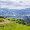
 Mission Peak Panorama and YSC Loop
5.1 mi 8.2 km • 1,196' Up 364.68 m Up • 1,194' Down 364.06 m Down
Pleasanton Ridge Loop
13.9 mi 22.4 km • 2,086' Up 635.79 m Up • 2,085' Down 635.64 m Down

 Byxbee Park
9.6 mi 15.5 km • 317' Up 96.49 m Up • 315' Down 96.01 m Down
 Up and Around Umunhum from Kennedy
30.2 mi 48.5 km • 4,983' Up 1518.84 m Up • 4,989' Down 1520.78 m Down
Los Gatos, CA
Mount Umunhum Loop
13.9 mi 22.4 km • 2,408' Up 733.96 m Up • 2,423' Down 738.53 m Down
Mt. Umunhum Out-and-Back
8.0 mi 12.8 km • 1,178' Up 359.01 m Up • 1,176' Down 358.55 m Down
Almaden…, CA


0 Comments