MTB Project Logo

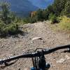
An easy bike trail along the Leutasche Ache River.


Your Rating: Rating Rating Rating Rating Rating      Clear Rating
Your Difficulty:
Your Favorites: Add To-Do · Your List
Zoom in to see details
Map Key

9.8

Miles

15.7

KM

Doubletrack

4,063' 1,239 m

High

3,381' 1,031 m

Low

142' 43 m

Up

816' 249 m

Down

2%

Avg Grade (1°)

8%

Max Grade (4°)

Dogs Unknown

E-Bikes Unknown

Description

From the Parkplatz Salzbach (Parking Area) or the connecting Leutascher Ache trail, this trail crosses through several small Austrian villages (notably Klamm, Leutasch, and Fohrenwald) as it travels east along the Leutasch Ache Creek eastward towards the Austrian border and the German town of Mittenwald.

At the Parkplatz Salzbach, cross a bridge over the Leutascher Ache Creek for a welcome bit of singletrack along the south bank. The singletrack section is about one mile before you'll cross a bridge over the creek to the main valley road. Follow the road for less than 100 m and then turn back across another bridge over the creek again onto the bike path.

The segment of the bike path has a gravel base and gently slopes down the valley. The eastern terminus of the bike trail is at the L14 road which (continuing east) will take you across the border to Mittenwald where there are good connections with other trails and a main train station.

Shared By:

Lost Justpastnowhere

Trail Ratings

  3.0 from 1 vote

#1

in Obern

#28205

Overall
  3.0 from 1 vote
5 Star
0%
4 Star
0%
3 Star
100%
2 Star
0%
1 Star
0%
Trail Rankings

#1

in Obern

#13

in Austria

#28,205

Overall
1 Views Last Month
107 Since Jan 23, 2017
Intermediate Intermediate

0%
0%
100%
0%
0%
0%

0 Comments

Current Trail Conditions

Unknown
Add Your Check-In

Check-Ins

Sep 26, 2014
Lost Justpastnowhere
Welcome

Join the Community

Create your FREE account today!
Already have an account? Login to close this notice.

Get Started