
 Continue with onX Maps
 Continue with Facebook


 Intermediate

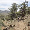
“Death Valley Road to Papoose Flat. ”


10.8
Miles17.4
KMDoubletrack
 Intermediate
Land Manager: USFS - Inyo National Forest Office
 Papoose Flat Loop
26.1 mi 42.0 km • 3,472' Up 1058.2 m Up • 3,471' Down 1058.03 m Down
 Little Pine-McMurry Loop
9.5 mi 15.3 km • 1,522' Up 463.78 m Up • 1,537' Down 468.36 m Down
Westgard Pass Loop
8.3 mi 13.3 km • 1,143' Up 348.33 m Up • 1,145' Down 348.86 m Down
 Green Lake Loop
20.3 mi 32.7 km • 4,603' Up 1402.88 m Up • 4,595' Down 1400.51 m Down
 West Bi…, CA
 Coyote Flat Traverse
27.9 mi 44.9 km • 6,350' Up 1935.59 m Up • 6,191' Down 1886.92 m Down
 Volcanic Tablelands Loop
24.3 mi 39.1 km • 1,308' Up 398.64 m Up • 1,308' Down 398.63 m Down


0 Comments