
 Continue with onX Maps
 Continue with Facebook


 Intermediate

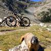
“A flowy ride along the JQS rim with incredible views of Garfield County. ”


1.1
Miles1.8
KMSingletrack
 Intermediate
Land Manager: BLM Colorado - Colorado River Valley Field Office
 Hogback Hot Lap
5.3 mi 8.6 km • 670' Up 204.18 m Up • 669' Down 203.92 m Down
 Rifle, CO
 Rifle Grand Hogback Complete
9.6 mi 15.5 km • 1,276' Up 389.06 m Up • 1,281' Down 390.39 m Down
Rifle, CO
New Castle Dirty Dozen MTB Race
10.9 mi 17.6 km • 1,825' Up 556.12 m Up • 1,837' Down 559.87 m Down
New Castle, CO
 The Ute Trail
80.8 mi 130.0 km • 7,871' Up 2399.04 m Up • 8,295' Down 2528.4 m Down
Colorado Trail: The Entire MTB Route - IMBA EPIC
549.3 mi 884.0 km • 71,117' Up 21676.5 m Up • 69,664' Down 21233.6 m Down
 Roxboro…, CO


0 Comments