
 Continue with onX Maps
 Sign in with Facebook


 Intermediate

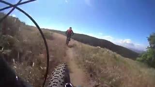
“A wide fire road that leads you to the top of Liebre Mountain and Sawmill Campground. ”


15.2
Miles24.4
KMDoubletrack
 Intermediate
Land Manager: USFS - Angeles National Forest Office
 Liebre Mountain Loop
17.1 mi 27.5 km • 2,228' Up 679.12 m Up • 2,230' Down 679.75 m Down

 Lebec, CA
 Tapia Canyon Rd Singletrack
19.0 mi 30.6 km • 1,934' Up 589.37 m Up • 1,934' Down 589.39 m Down
Castaic, CA
Towsley Canyon
5.1 mi 8.2 km • 1,097' Up 334.38 m Up • 1,102' Down 335.82 m Down
Wildwood Canyon Double Loop
3.2 mi 5.2 km • 629' Up 191.62 m Up • 630' Down 192.16 m Down
 Creek Trail to Elsmere Canyon Loop
3.1 mi 5.0 km • 606' Up 184.62 m Up • 606' Down 184.63 m Down
Sisar to Horn Canyon
15.7 mi 25.2 km • 3,683' Up 1122.61 m Up • 3,969' Down 1209.7 m Down
Ojai, CA


0 Comments