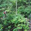
“A singletrack trail with a few small creek crossings. ”
1.7
Miles2.8
KMSingletrack

Local Club: Pisgah Area SORBA
Land Manager: USFS - Pisgah National Forest, Pisgah Ranger District
 Bent Creek Epicito
20.6 mi 33.2 km • 2,602' Up 793.01 m Up • 2,606' Down 794.42 m Down


 Bent Creek, NC
 Bent Creek Epicito v2
27.4 mi 44.2 km • 3,312' Up 1009.57 m Up • 3,323' Down 1012.85 m Down


 Bent Creek, NC
 Northern Loop
12.4 mi 19.9 km • 1,424' Up 434.08 m Up • 1,425' Down 434.47 m Down


 Bent Creek, NC
 Fletcher Creek
9.5 mi 15.3 km • 712' Up 217.13 m Up • 719' Down 219.2 m Down


 Avery C…, NC
 Pisgah Stage Race - Stage 4
32.1 mi 51.6 km • 3,729' Up 1136.46 m Up • 3,728' Down 1136.34 m Down


 Brevard, NC
 Avery Creek to Bennett Gap Loop
15.7 mi 25.2 km • 3,013' Up 918.33 m Up • 3,017' Down 919.45 m Down


 Brevard, NC


0 Comments