
 Continue with onX Maps
 Continue with Facebook


 Intermediate

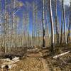
“This section of the Tabeguache Trail descends to Cactus Park then drops down to Highway 141. ”


26.8
Miles43.2
KMDoubletrack
 Intermediate
Local Club: Colorado Plateau Mountain Bike Trail Association
Land Manager: BLM Colorado - Grand Junction Field Office
 Black Pine Ridge Loop
6.0 mi 9.6 km • 510' Up 155.6 m Up • 511' Down 155.81 m Down

 Redlands, CO
 Grand Junction Off-Road 40 Grand Course
39.4 mi 63.4 km • 5,483' Up 1671.09 m Up • 5,482' Down 1671.04 m Down
 Kids Meal
1.5 mi 2.5 km • 146' Up 44.63 m Up • 154' Down 46.86 m Down
 Gateway Trails Tour
8.0 mi 12.9 km • 577' Up 175.89 m Up • 575' Down 175.18 m Down
Gateway, CO
Flowing Park Loop
15.2 mi 24.5 km • 484' Up 147.53 m Up • 491' Down 149.53 m Down
Kokopelli Loops - Mary's, Horsethief, Steve's, and Wranglers
18.7 mi 30.1 km • 1,568' Up 478.03 m Up • 1,565' Down 476.9 m Down
Loma, CO


0 Comments