
 Continue with onX Maps
 Continue with Facebook


 Easy/Intermediate

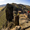
“An enjoyable ride before the La Garita Wilderness detour; combines easy riding on some doubletrack and singletrack. ”


12.9
Miles20.7
KMSingletrack
 Easy/Intermediate
 Monarch Crest to Agate Creek Loop
35.9 mi 57.8 km • 4,132' Up 1259.44 m Up • 4,088' Down 1246.06 m Down
 Monarch Crest to Starvation Creek
28.5 mi 45.9 km • 1,560' Up 475.48 m Up • 5,425' Down 1653.59 m Down
Monarch Crest to Green's Creek
14.0 mi 22.5 km • 673' Up 205.21 m Up • 3,417' Down 1041.49 m Down
Salida, CO
 Sage Burner 13K
8.3 mi 13.4 km • 1,208' Up 368.24 m Up • 1,207' Down 368 m Down
 Signal Peak Loop
21.8 mi 35.1 km • 1,955' Up 595.95 m Up • 1,944' Down 592.57 m Down
 Chalk Creek Pass
8.4 mi 13.5 km • 1,069' Up 325.81 m Up • 2,439' Down 743.44 m Down


0 Comments