Dogs Leashed

E-Bikes
Unknown
Family Friendly
Some very family friendly and fun trails with plenty to explore for the young'ins. Dinosaur tracks can be seen at various locations throughout the park when the water is low enough.

Call after it rains, as standing water will close the trails.
Overview
With roughly 17 miles of trail and growing, this park has a lot to offer with challenging terrain, steep bluffs and deep crevasses to get lost in. Many routes can be put together to get the most out of what you enjoy. You'll find steep, lung busting climbs, long fast downhills (as far as Texas goes) and remote outback sections to just get your pedal on. It has it all.
Need to Know
This is a State Park so there is a $5 fee at the gate. There are R.V. hookups as well as tent site campgrounds with restrooms and showers. There is also remote tent camping available out on the trails. Potable water can be found at the main trailhead and around campgrounds. You'll need plenty of this in the summer!! There is also a small store in the park. You may get wet at the river crossing when the river is up.
Description
This ride is a blast. These trails are muti-directional, although I pick the routes and direction with the least amount of suffering (yet there is still plenty) and most enjoyable downhills in mind.
On this ride from the trailhead you'll follow the footpath down to the river and hike across. Head back on the sandy singletrack of
Cedar Brake Outer Loop to the DORBA sign turning right and going up the tricky rocky climb. Take a left at the marker onto the alternate entry to Denio Creek Warbler Trail, and follow along a flowy ridge line that bobs and weaves up and down until returning to a creek crossing.
From here, you'll end up looping back into the older original Denio Creek Warbler Trail until it T's into the
Cedar Brake Outer Loop. Here I go right and hit a long uphill eventually following the fence line at the north end of the park. At the top of this climb you have a pretty fun, longish downhill.
Halfway down, turn right onto the Cedar Ridge Trail that climbs a bit then winds around, coming out to a camp site. Going down the hill, take a left at the intersection onto the Denio Creek Warbler Trail, and follow it until you reach the
Buckeye Trail.
Go left and follow the jeep road till you see a small waterfall / pond. You can go right at the small waterfall or continue to the fence line and rejoin the
Cedar Brake Outer Loop,and go right. Continuing on the
Cedar Brake Outer Loop finds the trail mellow out a for a good couple of miles with only smallish climbs and pedal-ly sections through the Cedars until it gets to a small remote campsite #7. From there, it begins a nice flattish to mostly gentle rolling downhill grade that gets faster the further you get into it until finally crossing the Buckeye creek.
From the marker go right onto the
Buckeye Trail for a short distance then take the first left going back up the hill until reaching the Cedar Ridge Trail. This trail takes you to the top of the bigger hills again and follows along at a fairly easy grade on mostly hard packed singletrack. The route remains nice and flowy through Cedar, Juniper and Scrub Oak for a little over half a mile until reaching the Denio Creek Warbler Trail.
Go left onto the Denio Creek Warbler Trail, and follow for roughly a quarter mile coming to a sizable trail intersection.Go left here and you'll be hitting one of the funnest downhills out here that takes you back down to the Denio Creek. Cross the creek and follow the trail until you hit the
Cedar Brake Outer Loop again.
This time go left and you'll begin a long easy grind uphill on doubletrack for a ways until returning to singletrack, taking you to the northwest side of the parks trails. It winds up in the furthest most remote area of the park along the fence line that is fairly flat and rocky singletrack with lots of cactus and pretty exposed as there are not many trees. Locals call this area "Africa". It winds around finally bringing you to an open gate area that meets with the
Black-Capped Vireo Trail.
Following the
Black-Capped Vireo Trail is a nice fairly easy singletrack pedal through the cedars again with gentle ups and downs over loose and embedded rock and hard pack soil. There are a few spots with small 10-12 inch plate rocks strewn around sticking out of the dirt at all angles keeping you on your toes as you thread in and around, and finally coming back down a decently long fun downhill to the Denio creek bed again.
Again, there are lots of different ways to put together a good ride. Come out and find your own!
History & Background
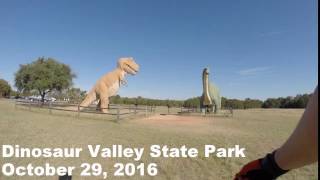
Some Dinosaur tracks left in the Limestone creek bed were dug up in the early 20th century and are now on display in the American Museum of Natural History in New York. Also, there is some controversy concerning the possibility of human prints that were said to be found alongside the Dino tracks. Look it up!
Contacts
Shared By:
keith radons

 Continue with onX Maps
 Sign in with Facebook


 Intermediate/Difficult


5 Comments