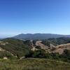
“A straight shot out and back to the cliffs above Drakes Bay. ”
1.3
Miles2.1
KMSingletrack

 Lucas Valley Loop
14.9 mi 23.9 km • 2,977' Up 907.35 m Up • 2,975' Down 906.7 m Down


 Lucas V…, CA
 Pine Mountain Loop
13.4 mi 21.5 km • 1,796' Up 547.55 m Up • 1,801' Down 548.9 m Down


 Fairfax, CA
 Fairfax-Bo Ridge Gravel Grinder
43.0 mi 69.3 km • 3,369' Up 1026.92 m Up • 3,369' Down 1026.82 m Down


 Fairfax, CA
 Helen Putnam Regional Park
8.3 mi 13.3 km • 1,282' Up 390.85 m Up • 1,282' Down 390.7 m Down


 Petaluma, CA
 To Tamarancho and Beyond (auto free)
30.4 mi 48.9 km • 4,394' Up 1339.17 m Up • 4,364' Down 1330.16 m Down


 San Rafael, CA
 Headlands Marincello Bobcat Miwok Old Springs
7.3 mi 11.8 km • 1,310' Up 399.15 m Up • 1,314' Down 400.65 m Down


 Tamalpa…, CA


0 Comments