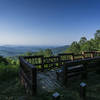
“Doubletrack climb from Hwy 64 to Benton Falls. ”
4.5
Miles7.2
KMSingletrack

Land Manager: USFS - Cherokee National Forest Office
 Cohutta Death March
68.9 mi 110.9 km • 7,609' Up 2319.3 m Up • 7,616' Down 2321.3 m Down


 McCaysv…, GA
 Mulberry Gap: Bear Creek, P1 and P2 Loop
23.6 mi 37.9 km • 3,002' Up 915.03 m Up • 2,963' Down 903.05 m Down


 Chatsworth, GA
 Brutal Loop 2
34.7 mi 55.9 km • 4,514' Up 1375.88 m Up • 4,517' Down 1376.73 m Down


 Chatsworth, GA
 Fightingtown Creek Nature Preserve
9.8 mi 15.8 km • 773' Up 235.54 m Up • 775' Down 236.28 m Down


 Blue Ridge, GA
 Bauxite
17.5 mi 28.1 km • 1,396' Up 425.51 m Up • 1,393' Down 424.51 m Down


 College…, TN
 Stanley Gap Loop
14.4 mi 23.2 km • 2,072' Up 631.45 m Up • 2,061' Down 628.27 m Down


 Blue Ridge, GA


1 Comment