
 Continue with onX Maps
 Sign in with Facebook


 Easy
Easy

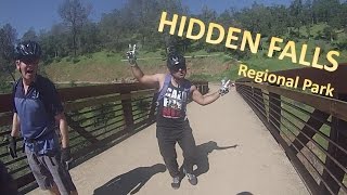
“A scenic fire road descending into the canyon. ”


3.8
Miles6.1
KMDoubletrack
 Easy
Easy
Local Club: Folsom Auburn Trail Riders Action Coalition
Jun 26, 2025: The Importance of Advocacy in the Mountain Biking World
May 30, 2025: Beyond the Ride: The Benefits of a Trail Steward Membership for Mountain Bikers
Land Manager: Placer County, CA - Parks and Grounds
 Confluence to Maine Bar
10.3 mi 16.6 km • 1,159' Up 353.3 m Up • 1,160' Down 353.71 m Down


 Tour of the ASRA with No Road Riding - Nates Pretzel Loop
24.8 mi 39.9 km • 3,380' Up 1030.12 m Up • 3,380' Down 1030.31 m Down
Auburn…, CA
 Salmon Falls Trail to Flagstaff Hill
14.1 mi 22.7 km • 1,929' Up 588.01 m Up • 1,927' Down 587.49 m Down
Salmon Falls (Darrington Trail)
15.9 mi 25.6 km • 717' Up 218.52 m Up • 717' Down 218.57 m Down
Magnolia to Cronan Loop
8.7 mi 14.0 km • 986' Up 300.48 m Up • 986' Down 300.63 m Down
Round Mountain Loop
10.8 mi 17.4 km • 2,088' Up 636.47 m Up • 2,090' Down 637.06 m Down


0 Comments