MTB Project Logo

A super rocky mix of fun downhills and tough climbs.


Your Rating: Rating Rating Rating Rating Rating      Clear Rating
Your Difficulty:
Your Favorites: Add To-Do · Your List
Zoom in to see details
Map Key

2.4

Miles

3.9

KM

Singletrack

1,326' 404 m

High

837' 255 m

Low

489' 149 m

Up

471' 144 m

Down

7%

Avg Grade (4°)

18%

Max Grade (10°)

Dogs Unknown

E-Bikes Unknown

Description

I labeled this trail as singletrack, but it's really kind of a mix of singletrack and wider-than-singletrack-but-not-really-doubletrack. Some areas of the trail get to be 4-6 feet wide, but don't think that makes this an easy ride.

In the direction I've posted, it starts as a fun rocky downhill section that has a good flow to it. A few of the corners are a little loose and rocky, especially in the summer months. For the most part though you can really rail the corners. There are some small rock drops, but nothing too technical or gnarly.

About halfway through the loop, you'll start the climb back up. It's not a particularly steep climb, though it gets fairly steep for brief periods throughout. It's the rocks that really make it tough. There is a pretty good line through most of the climb, but the rocks are always there. This trail really gives you a chance to work on controlling your cadence and power application to prevent loosing traction.

In the clockwise direction, this trail is pretty similar. It starts with a fun, flowy downhill and transitions into a long, tough climb. I think the downhill is a bit more fun counterclockwise, but it's also a tougher climb.

Contacts

Shared By:

Doug Seybert Jr

Trail Ratings

  3.3 from 6 votes

#21714

Overall
  3.3 from 6 votes
5 Star
17%
4 Star
17%
3 Star
50%
2 Star
17%
1 Star
0%
Trail Rankings

#1,690

in California

#21,714

Overall
7 Views Last Month
705 Since Jun 14, 2013
Difficult Difficult

0%
0%
0%
0%
100%
0%

Photos

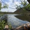
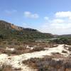
Sloped and rocky section on the south side of the trail.
Nov 12, 2021 near San Marcos, CA
Heading up to the benches after finishing the Equine Incline loop in the counter-clockwise direction.
Jun 30, 2013 near San Marcos, CA
This is the beginning of the Equine Incline loop running in the clockwise direction.
Jun 30, 2013 near San Marcos, CA

0 Comments

Weather


Current Trail Conditions

All Clear 41 days ago
Add Your Check-In

Check-Ins

May 31, 2018
Jonathan Ley
All clear 2.4mi
Aug 23, 2013
Bryce Knudson
Do you like Rock Gardens? Well, here lie the finest San Diego rock gardens around. Fun, steep, technical loop. 2.4mi
Welcome

Join the Community

Create your FREE account today!
Already have an account? Login to close this notice.

Get Started