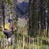
“Is this the trail Lewis and Clark used? Perhaps - it sure is good singletrack in any case. ”
2.1
Miles3.3
KMSingletrack

Local Club: Salmon Idaho MTB Assoc
Land Manager: BLM Idaho - Salmon
 Enduro Loop
9.4 mi 15.1 km • 675' Up 205.81 m Up • 675' Down 205.67 m Down


 Salmon, ID
 Rippey Spring Loop
11.0 mi 17.8 km • 1,525' Up 464.94 m Up • 1,526' Down 465.24 m Down


 Salmon, ID
 Elk Loop
9.4 mi 15.2 km • 1,477' Up 450.25 m Up • 1,477' Down 450.08 m Down


 Salmon, ID
 Twelvemile to Lime Creek
12.9 mi 20.7 km • 2,013' Up 613.58 m Up • 4,419' Down 1346.8 m Down


 Salmon, ID
 Bradley Gulch to Sheep Creek
14.5 mi 23.4 km • 1,161' Up 353.97 m Up • 4,016' Down 1224.17 m Down


 Salmon, ID
 Butcherknife - Ax Park
15.6 mi 25.1 km • 2,064' Up 629.07 m Up • 4,257' Down 1297.65 m Down


 Salmon, ID


0 Comments