MTB Project Logo

Amazing loop to get close to the Batamote Mountains, with an easy warm-up out and cool-down back to Ajo.


Your Rating: Rating Rating Rating Rating Rating      Clear Rating
Your Difficulty:
Your Favorites: Add To-Do · Your List
Zoom in to see details
Map Key

22.8

Miles

36.7

KM

0%

Singletrack

1,719' 524 m

High

1,471' 448 m

Low

506' 154 m

Up

507' 154 m

Down

1%

Avg Grade (0°)

4%

Max Grade (2°)

Dogs Unknown

E-Bikes Unknown

Overview

This is mapped counter-clockwise, but could be just as fun (or maybe more fun?) riding this loop clockwise.

Need to Know

Fatter tires or suspension will make Batamote Basin mo' fun and comfy, but almost all of this loop could be ridden on a gravel bike by an expert rider - sans some of the wider, deeper wash crossings. I did have cell reception during most of this route when ridden in late March 2021 (Verizon), as a safety consideration. It is far enough from town you'll want to take extra precautions from flats or other mechanical issues, and take plenty of water (as always in the Sonoran Desert)!

Description

Start at Bud Walker Park in Ajo and head north on Olive Branch to Tailings East, and continue east on Dangal (BLM 8106A) and Saikil (BLM 8106A) to Batamote Basin.

Follow Batamote Basin to Batamote View out-and-back if desired, or skip that extra bit to catch the turn on Fattire Mike near Teddy Bear Hill (the hill with tons of Teddy Bear Cholla cacti). Catch the western side of Noah's Cutoff to Desert Railroader (BLM 8106), then back to town on Desert Luge (BLM 8110A).

The easier trails across the valley make for a great warm-up / cool-down at the beginning and end of the ride, while the middle section includes more varied terrain including large sasquatch-sized babyheads on parts of the Batamote Basin and nearby trails.

Not a lot of elevation gain and most of the hills are associated with wash crossings and tend to be quite short and occasionally steep. Some of those include deep, loose sand and/or gravel, but most wash crossings on this loop are narrow.

History & Background

There is all kinds of history around this area that I wish I knew more about! Check out the Ajo Historical Museum for more about the area.

Contacts

Local Club: Bike Ajo

Land Manager: BLM - Lower Sonoran Field Office

Shared By:

Danny Martin

Trail Ratings

  4.0 from 1 vote

#2

in Ajo

#3016

Overall
  4.0 from 1 vote
5 Star
0%
4 Star
100%
3 Star
0%
2 Star
0%
1 Star
0%
Recommended Route Rankings

#2

in Ajo

#115

in Arizona

#3,016

Overall
7 Views Last Month
140 Since Mar 27, 2021
Intermediate/Difficult Intermediate/Difficult

0%
0%
0%
100%
0%
0%

Photos

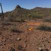
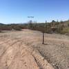
Looking N from the intersection of Desert Luge & E. Walker (powerline).
May 19, 2021 near Ajo, AZ
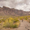
Looking N down the Desert Luge (BLM 8110A), with Batamote Mountain on the horizon.
May 19, 2021 near Ajo, AZ
Looking north on 8106A from Saikil, towards the Batamote Mountains.
Mar 28, 2021 near Ajo, AZ
Looking E from the intersection of Batamote Basin & Rekha's Hill (the small basaltic hill in foreground; 8106F).
May 15, 2021 near Ajo, AZ
Looking W from the intersection of Batamote Basin (8106A) and Batamote View (8106F), near Teddy Bear Hill (on right, referring to many Teddy Bear Cholla cacti).
May 15, 2021 near Ajo, AZ
Looking SW towards Fattire Mike (8106F) from Batamote Basin (8106A).
May 15, 2021 near Ajo, AZ

0 Comments

Weather


Current Trail Conditions

Unknown
Add Your Check-In

Check-Ins

none
Welcome

Join the Community

Create your FREE account today!
Already have an account? Login to close this notice.

Get Started