
 Continue with onX Maps
 Continue with Facebook


 Intermediate

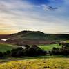
“One of the most pure XC trails in the East Bay. ”


9.0
Miles14.5
KMDoubletrack
 Intermediate
Local Club: Bicycle Trails Council of the East Bay
Land Manager: East Bay Regional Park District
 Shangri-lot (auto free)
17.9 mi 28.8 km • 2,165' Up 659.91 m Up • 2,040' Down 621.93 m Down


 Ridge-Sunol
6.2 mi 10.0 km • 1,150' Up 350.44 m Up • 1,150' Down 350.52 m Down
Coyote Hills
18.7 mi 30.2 km • 605' Up 184.27 m Up • 605' Down 184.37 m Down
Mission Peak Panorama and YSC Loop
5.1 mi 8.2 km • 1,196' Up 364.68 m Up • 1,194' Down 364.06 m Down
Dan Cook, Wall Point Loop
11.3 mi 18.2 km • 1,558' Up 474.84 m Up • 1,557' Down 474.64 m Down
 Las Trampas Madrone Loop
7.4 mi 11.9 km • 1,317' Up 401.46 m Up • 1,317' Down 401.4 m Down


1 Comment