Dogs Leashed

Features
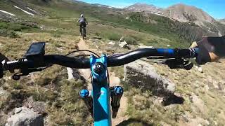
Commonly Bikepacked · Views
Overview
This is a bikepacking trip that can be done in two tough days or three slightly easier days.
Need to Know
Mirror Lake's level can fluctuate with available water. The road can be inundated necessitating a hike around the lake to re-access the road.
St. Elmo has a general store open during summer months.
Tin Cup Pass is a popular area for 4x4 enthusiasts.
Description
This route follows the Colorado South Park and Pacific railroad from Caulk Cliffs to Hancock. It passes over Williams Pass to again follows the railroad bed near the old townsite of Woodstock. An alternative route would be to follow the
Tunnel Lake Trail to the
Alpine Tunnel Connector and do a short hike-a-bike over the top to the west portal of the Alpine Tunnel. For a shorter option, start near St. Elmo.
A fast downhill puts you near Pitkin where you turn right to the Quartz Campground. In the spring, this area is filled with Fairy Slipper Orchids.
Continue north to Cumberland Pass followed by a fast downhill to the townsite of Tincup. This is the only place to obtain any kind of food or water on the route. Continue east on Forest Road 267 to Mirror Lake campground.
Out of Mirror Lake, a steep rocky climb awaits to the top of Tincup Pass. Some hike-a-bike awaits on this steep four-mile climb. The reward is the downhill from Tincup Pass back to St Elmo your car. Tincup Pass is popular with OHVs, so stay alert.
History & Background
St. Elmo was founded in 1880 & is one of the best preserved ghost towns in the west, with many historic buildings still standing.
Contacts
Shared By:
Stuart Black

 Continue with onX Maps
 Sign in with Facebook


 Intermediate/Difficult

 4.4 (7)


1 Comment