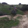
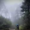
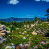
“A wide doubletrack that runs along the ridge above the Scott Canyon Trail. ”
0.7
Miles1.1
KMDoubletrack

Land Manager: City of Loma Linda - Public Works
 Jedi Tree and Back
4.2 mi 6.7 km • 484' Up 147.51 m Up • 497' Down 151.54 m Down


 Loma Linda, CA
 Hulda Crooks to Reche Canyon
4.4 mi 7.2 km • 619' Up 188.62 m Up • 642' Down 195.7 m Down


 Loma Linda, CA
 Southridge XC Course
5.8 mi 9.3 km • 710' Up 216.56 m Up • 708' Down 215.71 m Down


 Glen Avon, CA
 Sugarpine Mountain Drop, North Side via Powerline Rd
10.6 mi 17.0 km • 2,155' Up 656.81 m Up • 2,155' Down 656.82 m Down


 Crestline, CA
 Rim Nordic XC
8.7 mi 13.9 km • 1,034' Up 315.09 m Up • 1,043' Down 317.84 m Down


 Running…, CA
 South Shore to Santa Ana Loop
27.7 mi 44.5 km • 4,549' Up 1386.46 m Up • 4,549' Down 1386.45 m Down


 Big Bea…, CA


0 Comments