MTB Project Logo

A singletrack that will challenge along the way as well as provide a nice escape with views.


Your Rating: Rating Rating Rating Rating Rating      Clear Rating
Your Difficulty:
Your Favorites: Add To-Do · Your List
Zoom in to see details
Map Key

13.0

Miles

20.9

KM

100%

Singletrack

118' 36 m

High

39' 12 m

Low

451' 138 m

Up

453' 138 m

Down

1%

Avg Grade (1°)

9%

Max Grade (5°)

Dogs Unknown

E-Bikes Unknown

Overview

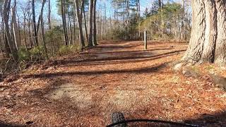
This singletrack works its way throughout the York River Park while crossing many of it's multi-use trails. You can enter or exit this trail at any point along the way to tailor your days ride. You'll find some technical obstructions along the way, but they can be bypassed if desired. John Blair Trail: Section C provides some great views of the York River!

Description

The 9.5-mile John Blair Trail can be accessed from many points along the way by using the park's multi-use trails. This trail can start off the Bobcat Run Trail, but in this case, it was started off the multi-use Pamunkey Trail.

The trail signs assign a new alphabetic designation at each multi-use trail crossing. This map begins at John Blair Trail: Section A and continues through sections John Blair Trail: Section B, John Blair Trail: Section C, John Blair Trail: Section D, John Blair Trail: Section E, John Blair Trail: Section F, John Blair Trail: Section G and ends at the terminus of the Backbone Trail.

I have included photos of every trail crossing so that you may choose where you would like to start and stop your ride if the full 9.5 miles doesn't appeal to you. I found John Blair Trail: Section B to be one of the harder sections, John Blair Trail: Section C to have the best views of the York River and John Blair Trail: Section E to be the longest and most frustrating because it approaches and backs away from the Whitetail Trail for such a long time without crossing it.

The first and last sections are the easiest which allows for a leg warm up and cool down. You return to the parking lot via the multi-use Backbone Trail.

Contacts

Shared By:

Donovan Fitzgerald

Trail Ratings

  4.0 from 18 votes

#1695

Overall
  4.0 from 18 votes
5 Star
39%
4 Star
33%
3 Star
22%
2 Star
0%
1 Star
6%
Recommended Route Rankings

#45

in Virginia

#1,695

Overall
33 Views Last Month
5,281 Since Feb 11, 2017
Intermediate Intermediate

13%
0%
87%
0%
0%
0%

Photos

A tree is down blocking the trail about halfway through the section. We had to walk our bikes around. The tree is leaning against another tree & looks like the continuous rain lately has caused the tree to fall.
Oct 31, 2020 near William…, VA
Fire Road
Jul 11, 2018 near William…, VA
You can spend a whole day here and you'll sleep well that night!
Mar 24, 2021 near William…, VA
Look for this sign marking the beginning of Section D off the Powhatan Forks East Trail.
Feb 11, 2017 near William…, VA
The Backbone Trail offers ample opportunity to observe history.
Feb 19, 2017 near William…, VA
This sign marks the beginning of Section E off the Riverview Trail.
Feb 11, 2017 near William…, VA
loading

Weather


Current Trail Conditions

All Clear 11 days ago
Add Your Check-In

Check-Ins

Join the Community

Create your FREE account today!
Already have an account? Login to close this notice.

Get Started.