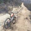
“A short climb out of the park to Lynnmere Drive. ”
0.6
Miles0.9
KMSingletrack

Local Club: Concerned Off-Road Bicyclists Association - CORBA
Land Manager: Conejo Recreation and Parks District
 Backbone Trail: Yerba Buena Section
4.7 mi 7.5 km • 483' Up 147.17 m Up • 443' Down 134.91 m Down


 Thousan…, CA
 Dead Cow/Suicide Loop
4.1 mi 6.6 km • 1,126' Up 343.27 m Up • 1,126' Down 343.17 m Down


 Oak Park, CA
 Backbone Trail: Encinal Canyon
10.2 mi 16.4 km • 1,177' Up 358.71 m Up • 1,177' Down 358.72 m Down


 Thousan…, CA
 Backbone Trail: Zuma Ridge to Encincal
2.4 mi 3.9 km • 345' Up 105.29 m Up • 685' Down 208.66 m Down


 Thousan…, CA
 El Escorpion to Cheeseboro Loop
18.7 mi 30.1 km • 2,355' Up 717.71 m Up • 2,355' Down 717.89 m Down


 West Hills, CA
 Crags-Bulldog-Mesa Peak
14.6 mi 23.5 km • 2,667' Up 812.85 m Up • 2,657' Down 809.83 m Down


 Malibu…, CA


0 Comments