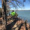
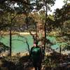
“A fun ride through the woods on singletrack along the western edge of Lake Murray. ”
5.4
Miles8.6
KMSingletrack

Local Club: Oklahoma Earthbike Fellowship
Land Manager: Oklahoma Tourism and Recreation
 West Shore
7.8 mi 12.6 km • 445' Up 135.59 m Up • 445' Down 135.66 m Down


 Ardmore, OK
 Lake Murray Big Loop to Pecan Grove
18.2 mi 29.3 km • 729' Up 222.12 m Up • 730' Down 222.61 m Down


 Ardmore, OK
 Lake Murray South Out-and-Back
17.8 mi 28.7 km • 645' Up 196.7 m Up • 646' Down 196.76 m Down


 Ardmore, OK
 Cross Timbers: Cedar Bayou to Rock Creek
11.3 mi 18.2 km • 942' Up 287.12 m Up • 942' Down 287 m Down


 Sherwoo…, TX
 Rock Creek Multi-Use Trail - North TH to South TH (and back)
10.3 mi 16.5 km • 555' Up 169.17 m Up • 555' Down 169.17 m Down


 Sulphur, OK


0 Comments