
 Continue with onX Maps
 Continue with Facebook


 Intermediate/Difficult
Intermediate/Difficult
Intermediate/Difficult
 Intermediate/Difficult
Land Manager: Mount Rogers National Recreation Area
 Iron Mountain Out-and-Back
25.7 mi 41.4 km • 3,717' Up 1132.93 m Up • 3,719' Down 1133.52 m Down

 Slab Town Trail
5.7 mi 9.2 km • 1,208' Up 368.05 m Up • 1,208' Down 368.24 m Down
 Wild Steer 6202
15.1 mi 24.3 km • 1,618' Up 493.03 m Up • 1,617' Down 492.95 m Down
Marion, VA
 Yelling and Dam Builder Loop
3.5 mi 5.6 km • 129' Up 39.4 m Up • 136' Down 41.4 m Down
 Bear Creek to Crawfish Ride
13.2 mi 21.3 km • 838' Up 255.56 m Up • 843' Down 256.8 m Down
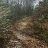
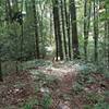
Forest Trail
1.1 mi 1.7 km • 231' Up 70.34 m Up • 243' Down 74.12 m Down
 Rural R…, VA


0 Comments