
 Continue with onX Maps
 Sign in with Facebook


 Easy
Easy

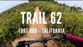
“East/West Road connects Hennekens Ranch Rd to Barloy Canyon Rd. ”


1.0
Miles1.6
KMDoubletrack
 Easy
Easy
Local Club: Monterey Off Road Cycling Association
Land Manager: BLM California - Hollister Field Office
 Best of Ord - Short
17.9 mi 28.8 km • 2,176' Up 663.12 m Up • 2,177' Down 663.56 m Down

 Salinas, CA
 Pipeline Loop
9.3 mi 14.9 km • 1,616' Up 492.63 m Up • 1,616' Down 492.47 m Down
Salinas, CA
2020 Sea Otter Cross Country - Category 1
29.4 mi 47.4 km • 3,419' Up 1042.14 m Up • 3,412' Down 1039.86 m Down
Del Rey…, CA
Road Runner to Razorback
5.2 mi 8.4 km • 702' Up 213.88 m Up • 702' Down 214.09 m Down
EMT, U-Con, Chinquapin, Pipeline
11.7 mi 18.8 km • 1,199' Up 365.55 m Up • 1,199' Down 365.48 m Down
Santa Cruz, CA
 Best of Wilder Ranch
16.6 mi 26.7 km • 1,371' Up 417.87 m Up • 1,361' Down 414.73 m Down


0 Comments