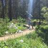
“A connector paralleling road leading to Keystone Gulch. ”
0.9
Miles1.4
KMSingletrack

Local Club: Summit County Mountain Bike Alliance
Land Manager: USFS - White River National Forest Office
 Dredge-CO-Red-Hay-Blair Witch Loop Trail
10.5 mi 16.9 km • 1,431' Up 436.32 m Up • 1,431' Down 436.31 m Down


 Keystone, CO
 Ptarmigan Peak
8.4 mi 13.6 km • 2,518' Up 767.38 m Up • 2,518' Down 767.58 m Down


 Silvert…, CO
 Frisco Peninsula Lakeshore Loop
6.1 mi 9.8 km • 217' Up 66.09 m Up • 173' Down 52.67 m Down


 Frisco, CO
 Little French Loop
12.6 mi 20.3 km • 1,659' Up 505.65 m Up • 1,659' Down 505.53 m Down


 Brecken…, CO
 Circumnavigation of Mt. Guyot
38.5 mi 62.0 km • 5,204' Up 1586.17 m Up • 5,312' Down 1618.96 m Down


 Brecken…, CO
 Breckenridge Flumes Loop
6.5 mi 10.4 km • 494' Up 150.42 m Up • 493' Down 150.4 m Down


 Brecken…, CO


0 Comments