Heading east, leave the Reedy Creek parking lot on the trail just before the car exit to the parking lot on the left. Ride across cement on the downstream side of the culverts that constitute the Riverside Drive bridge over Reedy Creek. Across the cement there is a 5 foot abrupt climb made of stone and cement, ride or walk up this to get to the trail.
Just after the exit to the Reedy Creek area (the 5 foot abrupt stone climb), there is a connector on the right for access to the Forrest Hill Park section of the trail. Buttermilk continues straight as opposed to taking this right.
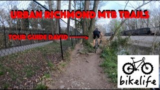
After this intersection the trail continues east for a mile going over a low ladder bridge over a swampy section as well as making a slight climb and descent. There are a considerable number of rocky sections that make maintaining speed difficult.
Eventually a fork comes up in the trail. Taking either the left fork or right fork keep you on the trail, the left is just slightly easier. After the forks reconvene continue east until you cross a parking lot and climb a hill.
At the top of this hill you'll come up on some stone steps, a kiosk, and a bridge that crosses the railroad tracks on your left. This is the intersection where Buttermilk Proper ends and you can either continue on straight to begin
Buttermilk East or turn left to head towards
Belle Isle and the Bike Skills Course.
To begin
Buttermilk East, continue straight down the steep root section (or carry your bike down) and follow the trail into the trees. To continue left on to
Belle Isle, walk across this bridge and down the steps on the other side (some people have been known to ride down the stairs, but I don't as to not tear up my tires). At the bottom of the steps you can take two ways to get to
Belle Isle: 1. the easier of the two directionally, along the fence that borders the railroad tracks, or 2. go down left and pick your way along a path that has been made on top of a cement pipe amongst slickrock and trees (note that you'll have to make a right to make it up to the bridge over to
Belle Isle to continue on the ride). Both routes will result with you ending up on the car access bridge to
Belle Isle on its south side.

 Continue with onX Maps
 Sign in with Facebook


 Intermediate/Difficult


 All Clear


1 Comment