MTB Project Logo

An easy, purpose-built singletrack lollipop trail perfect for an after-work ride.


Your Rating: Rating Rating Rating Rating Rating      Clear Rating
Your Difficulty:
Your Favorites: Add To-Do · Your List
Zoom in to see details
Map Key

2.7

Miles

4.3

KM

Singletrack

1,631' 497 m

High

1,569' 478 m

Low

85' 26 m

Up

92' 28 m

Down

1%

Avg Grade (1°)

4%

Max Grade (2°)

Dogs Unknown

E-Bikes Unknown

Closed when wet.

Description

This trail provides a purpose-built alternative to the South Plateau Loop and takes you out to O'Shaughnessy Point. It is easy, except for a somewhat rocky descent about a mile down the trail, just before reaching the intersection with the Bog Trail. Although the average mountain biker can handle this, the beginner mountain biker may have to walk his or her bike down this descent. The rest of the trail is comparatively easy, with the exception of small obstacles such as roots and avoidable rocks. A few optional features are scattered throughout this trail, as well.

The "stick' end of the lollipop is approximately 1.65 miles while the "circle" is about 1.1 mile. The first mile of the "stick" between the South Plateau Loop and the Bog Trail is the most flowing portion of it.

Start by entering the South Plateau Loop at the intersection with the Sinks Trail across the park road from the Bikers' Parking Lot. After about 400 feet, turn right onto the Family Bike Trail. The next mile is flowing and relatively fast with a few features to slow you down occasionally. This mile ends at the intersection with the Bog Trail and the Gravel Road. Cross the Bog Trail to continue on the Family Bike Trail.

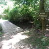
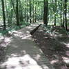
The section between the Bog Trail and the Fire Tower Trail is mostly a dense pine forest. A few roots and rocks will slow you down before you pick up too much speed here. It is also twisty. There is a wooden bridge at the end of this section of the trail just before reaching the Fire Tower Trail.

The trail then follows the Fire Tower Trail for a short distance to form part of the "circle". There are two exits halfway around the "circle" to the South Plateau Loop near O'Shaughnessy Point. Continue on the loop to return to the intersection with the Fire Tower Trail. This is the end of the 2.7 miles of the trail. Completing the entire lollipop loop by returning back on the stick portion of the trail will give about 4.5 miles of riding.

Contacts

Local Club: SORBA - Huntsville

Land Manager: Alabama State Parks

Shared By:

Zack Butler

Trail Ratings

  4.1 from 7 votes

#9916

Overall
  4.1 from 7 votes
5 Star
29%
4 Star
57%
3 Star
14%
2 Star
0%
1 Star
0%
Trail Rankings

#140

in Alabama

#9,916

Overall
1 Views Last Month
1,228 Since May 18, 2013
Easy/Intermediate Easy/Intermediate

20%
40%
40%
0%
0%
0%

Photos

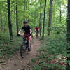
Family bike ride on the Family Bike Trail at Monte Sano State Park.
May 29, 2013 near Huntsville, AL
Biking the Family Bike Trail.
Nov 13, 2014 near Huntsville, AL
See if you can find the gnome on the Family Bike Trail in Monte Sano State Park!
Nov 12, 2013 near Huntsville, AL
Cycling down the Family Bike Trail at the Bog Trail intersection.
May 27, 2013 near Huntsville, AL
View from O'Shaughnessy Point.
May 14, 2013 near Huntsville, AL
The Gravel Road Trail in the fall.
Jun 17, 2013 near Huntsville, AL

0 Comments

Weather


Current Trail Conditions

Unknown
Add Your Check-In

Check-Ins

Join the Community

Create your FREE account today!
Already have an account? Login to close this notice.

Get Started.