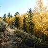
“Mostly gradual dirt road climb through high mountain valley. ”
6.0
Miles9.6
KMDoubletrack

Local Club: Cloud City Wheelers
Land Manager: USFS-Pike and San Isabel National Forest - Collegiate Peaks Wilderness
 Twin Lakes Trail
14.8 mi 23.8 km • 605' Up 184.42 m Up • 605' Down 184.28 m Down


 Leadvil…, CO
 Sugarloaf Lollipop
9.7 mi 15.6 km • 1,283' Up 391.17 m Up • 1,283' Down 391.1 m Down


 Leadvil…, CO
 Cloud City Challenge CHSMTB 2023
6.4 mi 10.4 km • 615' Up 187.56 m Up • 620' Down 188.9 m Down


 Leadvil…, CO
 Leadville Race Series - Silver Rush 50
49.9 mi 80.4 km • 7,369' Up 2245.93 m Up • 7,374' Down 2247.74 m Down


 Leadvil…, CO
 Aspen Fat Bike Loop
6.1 mi 9.8 km • 430' Up 131.04 m Up • 366' Down 111.56 m Down


 Aspen, CO
 Crystal Peak - Star Pass Big Loop
24.4 mi 39.3 km • 4,778' Up 1456.27 m Up • 4,780' Down 1457.08 m Down


 Crested…, CO


0 Comments