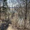
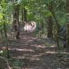
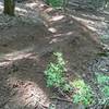
“A steep and short downhill flow trail located in a ravine. ”
0.1
Miles0.2
KMSingletrack

Local Club: SORBA - Middle Tennessee
Land Manager: Williamson County Parks & Recreation (WCPR)
 The Park at Harlinsdale Farm
3.3 mi 5.4 km • 166' Up 50.51 m Up • 166' Down 50.46 m Down


 Franklin, TN
 Middleberg/Columbia State Trails
1.2 mi 1.9 km • 126' Up 38.51 m Up • 115' Down 34.98 m Down


 Franklin, TN
 Toy Box, Boulevard, Wabash
4.5 mi 7.3 km • 385' Up 117.2 m Up • 385' Down 117.29 m Down


 Belle M…, TN
 Percy Warner Park Hookman Hill Loop
2.8 mi 4.5 km • 240' Up 73.09 m Up • 239' Down 72.83 m Down


 Belle M…, TN
 Cane Ridge Loop
4.5 mi 7.3 km • 222' Up 67.55 m Up • 221' Down 67.47 m Down


 Lavergne, TN
 Cane Ridge 1-4
8.9 mi 14.3 km • 476' Up 144.97 m Up • 472' Down 143.84 m Down


 Lavergne, TN


0 Comments