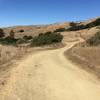
“A more interesting southeastern ridgeline approach to and descent from Mt. Tam than Old Railroad Grade. ”
2.5
Miles4.0
KMDoubletrack

Local Club: Access4Bikes (A4B)
Land Manager: Marin County Parks
 Easy Mt Tam: Mtn Home Inn to West Point Inn
8.5 mi 13.6 km • 873' Up 266.15 m Up • 866' Down 263.82 m Down


 Mill Va…, CA
 Camp Tamarancho Loop
10.8 mi 17.4 km • 1,407' Up 428.84 m Up • 1,406' Down 428.65 m Down


 Fairfax, CA
 Tennessee Valley to Horseshoe Bay
8.6 mi 13.8 km • 1,145' Up 348.94 m Up • 1,343' Down 409.2 m Down


 Tamalpa…, CA
 China Camp State Park Loop
8.7 mi 14.0 km • 772' Up 235.44 m Up • 772' Down 235.27 m Down


 Santa V…, CA
 Marin Fire Road Loop
27.3 mi 44.0 km • 4,309' Up 1313.28 m Up • 4,307' Down 1312.85 m Down


 Lagunit…, CA
 Havey Trail Loop
5.2 mi 8.3 km • 1,044' Up 318.24 m Up • 1,050' Down 319.93 m Down


 East Ri…, CA


0 Comments