MTB Project Logo

A short ride, but you'll have a great view of the upper valley at the top.


Your Rating: Rating Rating Rating Rating Rating      Clear Rating
Your Difficulty:
Your Favorites: Add To-Do · Your List
Zoom in to see details
Map Key

3.0

Miles

4.8

KM

Doubletrack

7,132' 2,174 m

High

6,290' 1,917 m

Low

654' 199 m

Up

859' 262 m

Down

10%

Avg Grade (6°)

72%

Max Grade (36°)

Dogs Off-leash

E-Bikes Allowed

You'll have to open and close one or two fence gates.

Need to Know

You'll likely see no one.

Description

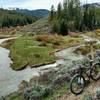
You can drive and park at the trailhead that branches off from the Grover Park Road. Trail starts between two boulders that sit like a gate at the trailhead; you can see them easily from the main road. First 400 feet of riding requires navigating a rock garden up a patch of trail where a small stream runs seasonally. You can clear it, but it takes a lot of bouncing around.

After clearing the stream bed/trail portion at the beginning of the loop, you just follow the ATV track for the next 2 miles or so, making sure to keep to the right and climb the steep incline after about 0.5 miles. During that section, you'll cover a gradual climb punctuated by some steep, short ascents, all doable for an intermediate, moderately in-shape biker.

Once you hit the plateau, you can exit the the trail left for 50 feet and get a great view of Jensen Canyon and look up at Twin Peaks. Get back on the trail and follow it around until just before it starts to drop. Before the ATV trail starts to descend, look to exit left on a trail that faintly appears to the left. Follow it down through the trees and out onto the mountain's shoulder, covered by small, exposed rocks and common mountain flora.

Descend along the shoulder, looking to pass between two large pine trees where the treeline and mountainside meet. You make a short, steep descent after passing the trees down to a saddle where the mountain rises again. At that point, turn right and follow the singletrack down to the meadow, 300 yards or so.

At the meadow, turn left and follow the singletrack all the way out where you'll emerge by the Grover town water tank above the cemetery. During the descent, you'll encounter two wire gates that you should make sure to close if they were closed when you reached them. At the cemetery, follow the road out to the Grover Park Road you started on.

Contacts

Shared By:

Kelly Fullmer

Trail Ratings

  3.0 from 1 vote

#27080

Overall
  3.0 from 1 vote
5 Star
0%
4 Star
0%
3 Star
100%
2 Star
0%
1 Star
0%
Trail Rankings

#390

in Wyoming

#27,080

Overall
1 Views Last Month
144 Since Jul 24, 2019
Intermediate/Difficult Intermediate/Difficult

0%
0%
50%
0%
50%
0%

Photos

At the top of the lookout before starting the descent.
Jul 24, 2019 near Afton, WY
Typical section of the single trail on the descent.
Jul 24, 2019 near Afton, WY

0 Comments

Weather


Current Trail Conditions

Unknown
Add Your Check-In

Check-Ins

none
Welcome

Join the Community

Create your FREE account today!
Already have an account? Login to close this notice.

Get Started