MTB Project Logo

Freeze Out Point to Tongue River Canyon TH! Have Fun!


Your Rating: Rating Rating Rating Rating Rating      Clear Rating
Your Difficulty:
Your Favorites: Add To-Do · Your List
Zoom in to see details
Map Key

9.4

Miles

15.1

KM

75%

Singletrack

8,221' 2,506 m

High

4,214' 1,284 m

Low

385' 117 m

Up

4,393' 1,339 m

Down

10%

Avg Grade (6°)

30%

Max Grade (17°)

Dogs Unknown

E-Bikes Unknown

Don't try to ride this during the Bighorn Mountain Run.

Overview

A downhill shuttle from Freeze Out Point to the mouth of Tongue River Canyon. It starts off on two-track and moves to singletrack after a few miles. This rag-tag ride offers some memorable views of the Northern Bighorns; steep on the descent and technical in last few miles of the canyon. Most people call this a 10-mile ride.

Need to Know

  • Navigating, especially along the start of the ride, can be tricky. Keep the MTB Project mobile app handy to keep on track.
  • Rattlesnakes, mean dogs, blitzed climbing bums, and pot-bellied wedding parties all frequent the canyon. Be wary. Most of these creatures have a gun.

Description

Start by leaving a retrieval vehicle at the Tongue River Canyon Campground or further down the canyon towards Dayton. Next, drive your shuttle vehicle up Highway 14 from Dayton, go onto 14a at Burgess Junction, and turn right on Road 15 to cross the N. Fork of the Tongue River. After a while, turn right onto Road 168 which feeds into Freeze Out Cow Camp Road (199). Keep straight to take Freeze Out Point Road (202) up to the overlook and the start of the ride.

Get on your bike and head back down Freeze Out Point Road (202), at the intersection turn right to ride the east half of Freeze Out Cow Camp Road (199) as it descends to the south into the canyon. Just after 1.5 miles, make a left turn onto the Amsden Elk Pasture Road (181) for a half-mile pedal before turning onto the start of the Horse Creek Trail #159. There are enough roads and paths in the area that it can be easy to get lost, but if you're on a faint jeep-track at this point, you're in the right place.

Descend into the trees before starting a stiff climb. The grade will peak out about a half-mile before the trail converges with Tongue River Canyon Trail #002 and begins a descent that will shoot riders down through the canyon.

The remainder of the ride is surreal and steep. Squirm down it like a bucking cutthroat trout. Yeehaw! Near the end of the canyon the trail encounters some drop-offs and some two-foot ledges to try and hop up. Falls might include rolling fifty feet into a whitewater river, so be on your game. Lower parts of the ride include oodles of tourists. Check your speed and give everyone else the right-of-way so bikers don't get banned from the trail.

Finally, don't bike this when muddy. This is part of the route for the Big Horn Mountain Race and people don't want to pay $200 to trip on your rutted out trail for 100 miles.

History & Background

The Bighorns are still wild. The nearby battle of the Little Bighorn was fought ten years after people in New York started riding subway cars to work. Plan appropriately.

Contacts

Shared By:

Laine Parish

Trail Ratings

  4.0 from 3 votes

#2661

Overall
  4.0 from 3 votes
5 Star
33%
4 Star
33%
3 Star
33%
2 Star
0%
1 Star
0%
Recommended Route Rankings

#37

in Wyoming

#2,661

Overall
3 Views Last Month
1,469 Since May 14, 2017
Difficult Difficult

0%
0%
0%
0%
100%
0%

Photos

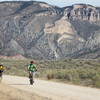
Nearby views from the  road up to the trailhead.
May 14, 2017 near Sheridan, WY
Narrow singletrack and beautiful views make the Tongue River Canyon a blast.
May 14, 2017 near Sheridan, WY
loading

Weather


Current Trail Conditions

Unknown
Add Your Check-In

Check-Ins

none
Welcome

Join the Community

Create your FREE account today!
Already have an account? Login to close this notice.

Get Started