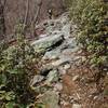
“A rocky singletrack in the hollow. ”
5.3
Miles8.6
KMSingletrack

Land Manager: USFS - George Washington & Jefferson National Forests
 Big Schloss Loop
9.6 mi 15.5 km • 1,658' Up 505.41 m Up • 1,644' Down 501.16 m Down


 Woodstock, VA
 Sherman Gap
6.7 mi 10.8 km • 1,361' Up 414.92 m Up • 1,361' Down 414.78 m Down


 Strasburg, VA
 Signal Knob - Meneka Peak - Bear Wallow Loop
8.7 mi 14.1 km • 1,752' Up 533.86 m Up • 1,746' Down 532.32 m Down


 Strasburg, VA
 Kern Mountain - Jawbone Overlook Ride
10.4 mi 16.7 km • 1,088' Up 331.65 m Up • 1,086' Down 331.16 m Down


 Mount J…, VA
 Duncan Hollow
12.5 mi 20.1 km • 1,577' Up 480.58 m Up • 1,620' Down 493.89 m Down


 Luray, VA
 Bird Knob and Catherine Furnace Loop
20.2 mi 32.5 km • 3,580' Up 1091.13 m Up • 3,581' Down 1091.51 m Down


 New Market, VA


0 Comments