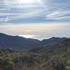
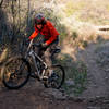
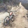
“A short downhill serving as a faster way down from Santa Rosa than the standard loop. ”
0.8
Miles1.3
KMSingletrack

Local Club: Concerned Off-Road Bicyclists Association - CORBA
Land Manager: Conejo Recreation and Parks District
 Backbone Trail: Encinal Canyon
10.2 mi 16.4 km • 1,177' Up 358.71 m Up • 1,177' Down 358.72 m Down


 Thousan…, CA
 Cheeseboro Loop
13.0 mi 20.9 km • 1,514' Up 461.46 m Up • 1,514' Down 461.44 m Down


 Agoura, CA
 Backbone Trail - Puerco Canyon Road Loop
26.0 mi 41.9 km • 4,251' Up 1295.61 m Up • 4,249' Down 1295.16 m Down


 Malibu, CA
 El Escorpion to Cheeseboro Loop
18.7 mi 30.1 km • 2,355' Up 717.71 m Up • 2,355' Down 717.89 m Down


 West Hills, CA
 Zuma Loop
13.2 mi 21.2 km • 2,760' Up 841.17 m Up • 2,757' Down 840.46 m Down


 Malibu, CA
 East Ridge, Harmon Trail 107 and Harmon Trail 105
4.3 mi 7.0 km • 625' Up 190.63 m Up • 625' Down 190.55 m Down


 Saticoy, CA


0 Comments