
 Continue with onX Maps
 Continue with Facebook


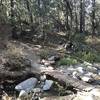
“An arterial access road that travels from the northwest to the center of the network. ”


2.4
Miles3.8
KMDoubletrack

Local Club: Idyllwild Cycling
Land Manager: USFS - San Bernardino National Forest Office
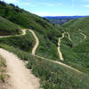
 Palm Canyon Route
14.6 mi 23.4 km • 2,524' Up 769.23 m Up • 2,927' Down 892.03 m Down

 The Desert Riders Tour
14.4 mi 23.2 km • 2,719' Up 828.71 m Up • 3,017' Down 919.54 m Down
 Bike For Bender Hell Ride
35.9 mi 57.8 km • 2,349' Up 716.11 m Up • 7,055' Down 2150.22 m Down
Big Bea…, CA
 Crafton Hills
9.9 mi 16.0 km • 1,369' Up 417.34 m Up • 1,367' Down 416.75 m Down
Oakmont Park
3.9 mi 6.3 km • 405' Up 123.59 m Up • 435' Down 132.53 m Down
Calimesa, CA
Mountain Home Creek - SART - Thomas Hunting Grounds Loop
20.4 mi 32.9 km • 3,075' Up 937.39 m Up • 3,061' Down 932.99 m Down


0 Comments