MTB Project Logo

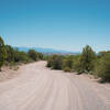
An old road that has been converted to a trail.


Your Rating: Rating Rating Rating Rating Rating      Clear Rating
Your Difficulty:
Your Favorites: Add To-Do · Your List
Zoom in to see details
Map Key

9.5

Miles

15.2

KM

Doubletrack

8,029' 2,447 m

High

6,922' 2,110 m

Low

1,425' 434 m

Up

319' 97 m

Down

3%

Avg Grade (2°)

17%

Max Grade (10°)

Dogs Unknown

E-Bikes Unknown

Description

This trail, part of the Continental Divide Trail (CDT), is really a road but it looks like singletrack in spots. It is good for a workout even if not technical. The nearby Salazar Trail #14 is much more interesting.

Note the USFS map is incorrect. It shows a route that crosses the fence 1000 feet south along the highway, then bushwhacks up the creek. The new trailhead is a large flat area off the highway. The entrance drops along the bank steeply so it is easy to overlook.

Contacts

Shared By:

John Geronimo with improvements by TMBA Taos Mountain Bike Association

Trail Ratings

  1.0 from 1 vote

#5

in Abiquiu

#40252

Overall
  1.0 from 1 vote
5 Star
0%
4 Star
0%
3 Star
0%
2 Star
0%
1 Star
100%
Trail Rankings

#5

in Abiquiu

#1,102

in New Mexico

#40,252

Overall
6 Views Last Month
788 Since Nov 4, 2016
Intermediate Intermediate

0%
0%
100%
0%
0%
0%

Photos

One of many muddy stream crossings on last quarter of 100 mile segment. This one was unrideable.
Aug 10, 2022 near Tierra…, NM
Sections have turned into singletrack.
Nov 4, 2016 near Tierra…, NM
The first hill.
Nov 4, 2016 near Tierra…, NM
Heading east.
Nov 4, 2016 near Tierra…, NM

0 Comments

Weather


Current Trail Conditions

Unknown
Add Your Check-In

Check-Ins

none
Welcome

Join the Community! It's FREE

Already have an account? Login to close this notice.