Dogs Leashed

E-Bikes
Not Allowed
Features
Commonly Bikepacked
Overview
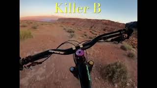
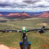
We took off from Moab and rode self-supported to Boulder Town, Utah, using as much dirt as we could. In about 290 miles, we went through only two towns, and linked together the San Rafael Swell, Capitol Reef National Park, and Grand Staircase-Escalante National Monument. Tons of potential for detours onto singletrack or other improvisation.
What I Brought:- Steel touring bike
- Revelate Designs Viscacha Seat Bag
- Revelate Designs Gas Tank Bag
- Revelate Designs Ripio Frame Bag
- Outdoor Research Duct Tape Dry Bag
- Camelbak Hawg 18 hydration pack
- Frame pump
- Patch kit
- Tire levers
- Extra chain links
- Leatherman Wave multitool
- Crank Brothers M17 multitool
- Chain lube and cleaner
- Zip ties
- Duct tape
- Baling wire
- Parachute cord
- Gorilla Glue
- Extra disc brake pads
- MSR Whisperlite Universal stove
- MSR Base cook pot
- Platypus GravityWorks 4-liter water filter
- MSR 4-liter Dromedary (one per person)
- Black Diamond ReVolt headlamp
- Big Agnes Copper Spur UL2 tent (fly and footprint only)
- Big Agnes Bellyache Mountain 17 sleeping bag
- ThermaRest Prolite sleeping pad
- Outdoor Research Deviator Hoody
- Outdoor Research Axiom Jacket (rain shell)
- Outdoor Research Tantrum Hooded Jacket (wind jacket)
- Outdoor Research Transcendent Hoody (down sweater)
- Outdoor Research Wayward Short Sleeve Shirt
- Outdoor Research Tangent Long Sleeve Shirt
- Outdoor Research Equinox shorts
- Outdoor Research Voodoo Pants
- Vasque Grand Traverse shoes
- POC Octal helmet
- Gnarly old Pearl Izumi winter gloves from 2010
Need to Know
There is one creek ford at approximately mile 190 - Muddy Creek. When we did it in mid-March, the creek was mid-shin height. Fatter tires recommended for sandy sections. Finding/managing your water supply is the crux. Reliable water is available in the town of Green River, in the San Rafael River about halfway across the San Rafael Swell, at the entrance station at Goblin Valley State Park, in the Rodeway Inn in Caineville, Utah, and in cattle ponds that can be seen along the route in satellite images.
Description
Ride north out of Moab on the canyon bike path, then cross the highway and turn left on UT-313. After climbing through a couple hairpin switchbacks, turn right onto Dublinky Well Road (dirt). You can ride any combination of dirt roads from there to Green River, but basically you want to keep trending north and slightly west. After almost 50 miles, you'll cross over I-70 on what's called Ruby Ranch Road on Google Maps and get on the old Highway 6 & 50, a rough, cracked old east-west frontage asphalt road that heads into Green River. From Green River (your last chance for supplies), ride down Main Street and merge onto I-70 for two miles, exiting onto US-6 heading northwest. This is just under 20 miles of pavement (which you could avoid if you want to do a little more complicated dirt route to the north side of the San Rafael Swell).
Turn west off of US-6 onto the gravel Green River Cutoff Road, and pedal through some rolling terrain to a left hand turn onto Buckhorn Draw Road. Ride southeast on this downhill-grade winding smooth dirt road as the red sandstone canyon walls climb up over your head—this is one of the most scenic sections of the trip. As you approach the San Rafael River, you'll exit the canyon and climb gradually up through the San Rafael Swell, with views of blocky sandstone towers all the way up until you cross under I-70 onto Temple Mountain Road. Follow the signs to Temple Mountain on dirt and gravel—when the road becomes narrower, rougher, and red, you'll know you're getting closer to Temple Mountain (and you'll eventually see it rise up to the east). The last 6-8 miles of the road to Temple Mountain are very rattly on a fully-rigid bike, but not unrideable.
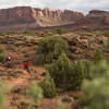
At the end of your descent past Temple Mountain, you'll coast onto pavement and turn south onto Goblin Valley Road (asphalt), and ride down it almost to Goblin Valley State Park. If you've never been to Goblin Valley, it's worth it to go in and check out the hoodoos, and fill up your water bottles at the gate. There's a nice campground there (with showers) if you're interested—otherwise there's free dispersed camping on the BLM land outside the park. Either way, you'll head west on Wild Horse Road (asphalt) until the paved section ends just past the trailhead for Little Wild Horse and Bell Canyons. A couple miles down the road from the trailhead, the road deteriorates significantly in the wash (you may have to walk a few miles here). At a trail sign for Ding and Dang Canyons, you'll follow the wash south as it winds through the lower section of Little Wild Horse Canyon—this is likely to be very sandy and not a hell of a lot of fun to ride on skinny tires.
After the canyon begins to open up, you'll climb out of it on a Jeep road on the right-hand side of the wash, to great views of the Henry Mountains and Factory Butte to the south. The road will parallel the Crack Canyon Wilderness Study Area, giving you views of large red-and-tan-striped dunes along the road. Continuing south, you'll ford Muddy Creek, then ride the flat gravel of Coal Mine Road to its intersection with UT-24. Turn west onto 24 and ride asphalt into Caineville, Utah, where there's a small convenience store in the Rodeway Inn.
From Caineville, continue west on 24, looking for a dirt road on the left at about 6.5 miles. Turn onto the dirt road and follow it for 3.5 miles to its intersection with Notom-Bullfrog Road (asphalt). The asphalt ends after 16 miles, and the dirt road has intermittent sandy sections but is generally pleasant all the way to its intersection with the Burr Trail, 22 miles from the end of the asphalt.
Turn west onto the Burr Trail and climb up the steep switchbacks. After the initial climb and a few rolling hills at the top, the road turns back into asphalt as you ride from Capitol Reef NP into Escalante NM. Rolling climbs and descents eventually lead into a winding descent into Long Canyon, a meandering red sandstone canyon, and then up and into Boulder Town.
Shared By:
Brendan Leonard
with improvements
by Moab Trail Mix

 Continue with onX Maps
 Continue with Facebook


 Intermediate


 Slickrock Complete Ride
 Moab, UT
 Rocky Jackson
 Intermediate Brands Loop
 Bar-M Loop


1 Comment